The Pedestrian Problem

We often rely on navigation apps to pedest—Google maps, Apple maps, Waze. You may ask aren't these apps enough?
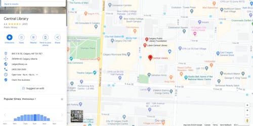
Well, let’s have a closer look. Google Maps is the most popular navigation tool so I’ll explore pedesting™ to Calgary’s new central library.
From Google, we can get contact information, it’s rating, and even find out how busy it is at certain times of the day.
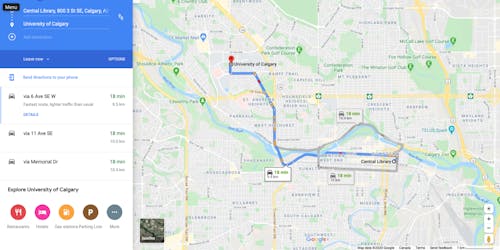
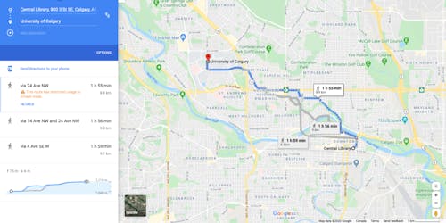
Now that we know where it is, let’s navigate to the library from the University of Calgary. We are given the option of driving, and it even shows traffic updates. We also have the option of getting transit and pedesting directions. However, the pedesting options are not nearly as accurate as it seems.
![]()
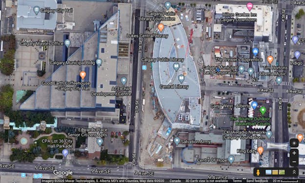
For example, when we arrive at the building, we have no idea how to get in. We can see the unique shape of the library building, but we can’t see where the entrance is (never mind the accessible entrance!) or even sidewalks and pathways to get around the building.
The satellite imagery can sometimes help figure out information related to the pathways and doors, but in this case, the image still shows a construction site. Related, Google street view can provide key insights, but again, it shows the new central library is still under construction.
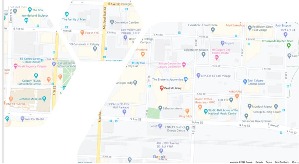
Taking a closer look at the pedesting directions, let’s look at how to get from the municipal building across the street to the library.
Goggle maps here shows that we have 3 potential routes that we can go across 7th avenue or the alternative routes go across 6th avenue or south to 9th Avenue.
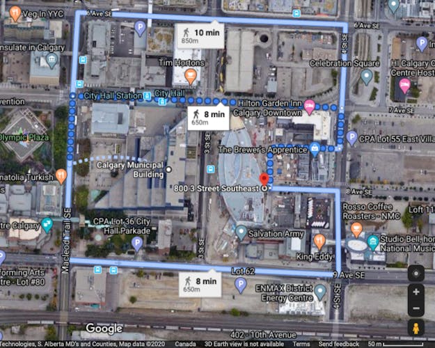
But looking closer at the satellite gives us a better sense of what actually that route is showing. And so we can see here ‑‑ I'll zoom in a bit ‑‑ this is the overall directions from the Calgary municipal building to the library. And zooming in closer, we can see here from our pedesting directions that it's asking us to float or arc from the center of the municipal building and we just float our way to the center of McLeod Trail—in the middle of the road!
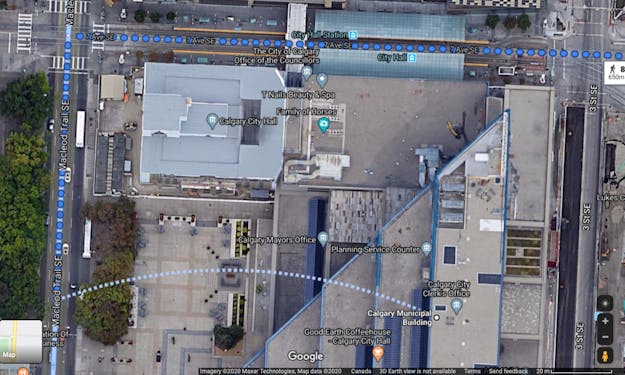
These directions do not consider sidewalks or pedestrian infrastructure. Pedestrian routes are calculated based entirely on the roads. Further, the routes are segmented and missing information that is essential in supporting pedestrian navigation.
These problems are amplified when you consider pedesters with mobility impairments, such as wheelchair users. But Pedesting™ isn’t just for wheelchair users. It’s for all people who need a bit of extra help to be a better pedestrian.